Facts
Location
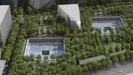
Sydney, Australia
Nemetschek Group Brands
Vectorworks
Technology used
Vectorworks Landmark
When it comes to planning a massive event like the Vivid festival in Sydney, Australia, having accurate and detailed map information about the dozens of sites spread across the metropolitan area is crucial. This information can be leveraged to make more informed decisions leading up to the event, such as planning installations.
That's where John Newman, director and principal landscape architect at NewScape Design, comes in. Using his expertise in Vectorworks Landmark and geographic information systems (GIS), he was able to create a digital map of Sydney that was instrumental in the planning of the 2023 Vivid festival.
About the Project | Vivid Sydney 2023
Vivid is an annual festival that celebrates creators, artists, and innovators from around the world. The 2023 festival spanned 23 days and nights, with events and performances taking place all throughout Sydney. 3.28 million people visited the festival during its duration. There were over 300 light, music, food, and innovation events across the city.
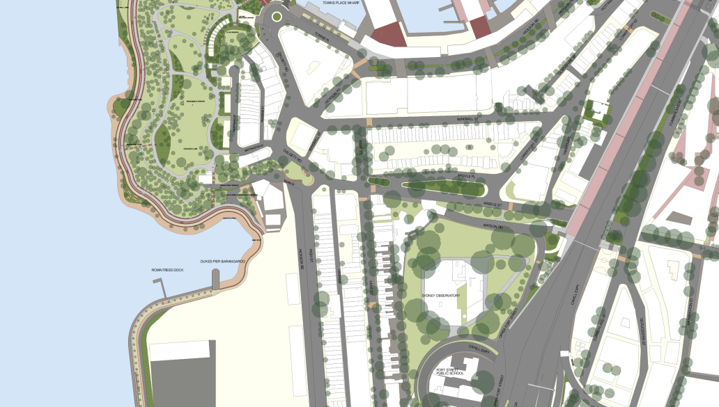
Destination NSW; the NSW Government’s tourism group that owns, manages, and produces Vivid; needed to update their maps of Sydney for planning of the 2023 event.
“Vivid initially approached us to prepare a map for Barangaroo Headland, which was being used by Vivid for the first time. They already had two separate Vectorworks files for their base plans of Darling Harbour and Circular Quay. Those files were very detailed, slow to work on, and weren’t geolocated. We could see that a new type of map, one that’s clear and easy to understand graphically, would be better suited to their application, and if it was geolocated then there were going to be benefits for future map updates,” Newman said.
“We were able to source some geolocated mapping showing roads and buildings from the City of Sydney. From there, we were able to use geolocated air photos to trace off the main site features such as trees, gardens, street furniture, lighting, walls and pathways.”
The Solution | NewScape Design’s Interactive Map of Sydney
Cities are constantly changing with new developments, roadways, buildings, and so on. This presented a problem for Destination NSW’s old drawings of Sydney — they were just drawings that weren’t geolocated, and it would have been difficult to update the existing maps if anything changed on site.
So, NewScape’s proposal to create a more robust georeferenced map — coupled with the rich graphics Vectorworks is known for — meant that the map would be able to be easily updated as the city changes. Any updates or new data sets made by the city can easily be imported into the drawing as .DWG or shapefiles.
“It’s funny in a way,” said Newman, “I don’t think they [Destination NSW] realized how fit for purpose the new map could be and they were unaware of the capabilities of Vectorworks. Once it become apparent what was possible, they engaged us to create a new map of the entire city that could change as the city landscape changed. “
Destination NSW could see the vast potential of this workflow with Vectorworks and were extremely happy with the result.
John Newman, Director at NewScape Design
The awesome thing about Vectorworks is you just have to dream. You just have to have an idea of what you want it to do, and it probably does it.
The Advantages of Geolocated Files
GIS allows you to make informed decisions and gain a comprehensive understanding of the site by integrating various data sets. Geolocated files are tied to real-world coordinates, so you can plan designs with real-world accuracy and manage projects more efficiently. Additionally, GIS helps communicate designs effectively, helping to ensure accuracy and transparency for those involved.
“When we send our projects over to installation contractors, we make sure to send them exact geographical coordinates,” Newman said. “That’s priceless. They don’t need to measure and create their own data points to find their bearings on site.”
Another benefit of having a geolocated digital map is that it has the potential to be uploaded to mobile apps, such as Avenza Maps, which allows participants to walk around the city and see their exact location on their device. For an event as large as Vivid Sydney, this could serve incredibly useful as artists, designers, and installation crews could use their devices to see exactly where their setups or installations are located.
The Rise of GIS | Crossing Industry Lines
GIS is traditionally used by landscape architects, civil engineers, architects, and surveyors to visualize spatial data, but its usefulness has opened new possibilities in various industries, including the live events industry.
With geolocated files, event organizers can analyze venue selection, crowd management, and logistics by accurately mapping event locations and overlaying data such as building footprints, public furniture, transportation routes, and so on. This helps enormously with pre-production and gives confidence for things like safety and security. GIS also helps to understand projected crowd flow and optimize spatial arrangements. Additionally, GIS site maps are becoming crucial backbones of live events by allowing for better coordination and planning among stakeholders.
And so it’s no surprise to see Destination NSW taking advantage of Vectorworks’ GIS capabilities to plan and manage Vivid Sydney.